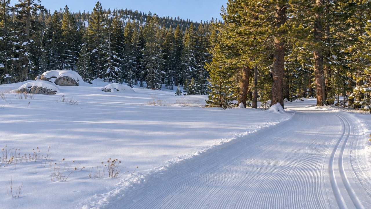
In the early hours of November 15, a snowcat ran up the Old Mt. Rose Highway above Tahoe Meadows and laid corduroy and classic tracks on a 2.01-kilometer stretch. Early the next morning, Nevada Nordic's grooming report said "The 2026/27 season is ON!" It also said the machine would stay parked that evening because a storm was on the way, with plans to go back out on the quad once it cleared.
For anyone living along Mt. Rose Highway, that track is the free part of winter. It's also run by a small nonprofit that most people skiing it have never paid a dollar to. The meadow around it is the busiest free snow area near Reno, and the state and federal agencies that share it scheduled their plan for handling the crowds to be finished this month.
Two Different Operations Share One Meadow
The Forest Service lists Tahoe Meadows for sledding and tubing, snowmobiling, cross-country skiing and snowshoeing. The December 2025 assessment of the area describes it as about 1,500 acres at nearly 9,000 feet. Its elevation means it gets snow earlier and keeps it longer than most places near Reno.
Inside that open country is a groomed network with its own operator. Nevada Nordic grooms about 20 kilometers of free multi-use trail. It does this under annual permits from the Lake Tahoe Basin Management Unit and the Nevada Department of Transportation. The trailhead is 4 miles west of Mt. Rose Ski Resort and 6 miles east of Incline Village. The first section from the lower lot is the Old Mt. Rose Highway, which NDOT owns. Nevada Nordic warns that parking at the lower lot "you will start your ski with a heart-pumping 1.3 mile climb up the Old Highway." Past that section, the loops are on National Forest land.
The rest of the meadow is sled hills, open snow and backcountry, and its users share access points that are few and close together. The assessment says the boundaries between motorized and non-motorized areas "can be difficult for visitors to recognize or interpret." Most friction, it says, comes from unclear signs and visitors who don't know local norms, not from bad intentions.
Who Pays for a Free Trail
Nevada Nordic says its operation is 100 percent funded by donations and its trails are free to use. Its 2026 sponsorship packet says more than $136,000 from over 450 donors covered the 2024/25 season. The same packet lists eight volunteer board members, 10 ambassadors and three paid groomers for the 20-kilometer network. It also reports 16 free clinics in 2024/25, including clinics for children and seniors. Local school teams and the Boys & Girls Club are among the groups that use the trails.
Because the trails depend on volunteers and donations, the etiquette matters more than it would at a resort. The rules come straight from Nevada Nordic's trail etiquette. Snowshoers stay to the side of the groomed trail, skate skiers use the middle and classic skiers stay in the tracks. The group says snowshoe prints "make the trails very hard to ski on." On the Old Highway section, dog owners are asked to keep dogs from post-holing the track and to pick up waste. A bag stand sits in the upper meadow section for skiers who forget to bring bags. The snowcat grooms every night, and skiers are asked to stay off the trails while it's working.
The corduroy a family skis on Saturday morning was laid overnight by one of those three paid groomers, and donors cover the cost.
The Roadside Is the Part Being Planned
Getting from the car to the snow is the hard part. The December 15, 2025 assessment was a joint effort of the U.S. Forest Service, NDOT and the Nevada Division of Outdoor Recreation, facilitated by the National Park Service. It describes a two-mile stretch of Mt. Rose Highway where parking and winter activity bunch up. "Each winter, hundreds of visitors park along snow-covered highway shoulders and cross the road at unmarked locations, often with children and gear in tow," the assessment reads. It adds that parked cars can block snowplows and emergency vehicles, and that the problem is worst right after a storm.
The busiest days follow a pattern. According to the TRPA Governing Board staff report from August 19, 2026, "parking demand exceeds available capacity" on holidays and on the days right after winter storms. Thanksgiving weekend after a mid-November storm is one of those days.
Nevada Nordic has its own storm-day request. Use one of the pullouts when it's snowing. If you park on the shoulder by the upper gate, park only on the side that already has cars, because cars on both sides make it hard for plow drivers to get through.
There are two developed stops. The Forest Service's Mt. Rose Summit Welcome Plaza is listed as a year-round, no-fee trailhead with vault toilets, about 15.6 miles west of I-580 on SR-431. The Tahoe Meadows Trailhead also charges no fee and has vault toilets. The Tahoe Rim Trail Association's November 2 trail conditions update reported that the Tahoe Meadows lot and restrooms were open, along with limited parking on the highway shoulder. The assessment says the area's summer facilities are closed or don't work in winter. Check the current status before counting on a restroom stop.
What the Agencies Are Working Toward
The plan's official name is the Tahoe Meadows Winter Safety Management Master Plan. NDOT, the Forest Service and the Nevada Division of Outdoor Recreation are writing it together, and it's meant to give them one framework for decisions, funding, maintenance, operations and future projects. The August 2026 schedule had stakeholder workshops and an online survey over the summer and fall, with the final plan due in November 2026. A state Board of Examiners contract summary lists Design Workshop, Inc. on a Tahoe Meadows winter-safety plan contract that runs through December 31, 2026.
This plan follows earlier work on the corridor. In 2011, NDOT did a road safety audit of the two-mile stretch through the meadows. It recommended options ranging from a 25-mph flashing speed zone to long-term off-highway parking and shuttles. In 2016, Washoe County commissioners adopted the Mount Rose Scenic Byway Corridor Management Plan. The assessment says many of that plan's recommendations match what stakeholders are asking for now.
The 14 organizations interviewed in spring 2025 suggested ideas at very different scales. The small ones were clearing gaps in the snow berms, loading zones and seasonal pedestrian crossings. The larger ones were designated off-highway parking, a managed snow-play zone, map kiosks and seasonal shuttles. The groups strongly agreed that Tahoe Meadows should stay "open and welcoming to the public." They suggested voluntary passes as one funding idea and warned against fees that would shut out lower-income or casual visitors. Several worried that permanent buildings would draw more people and change the area's character. Most preferred seasonal or portable facilities.
For Mt. Rose Highway residents, whatever comes out of this plan will change how winter mornings up the hill start: where you park, where you cross, and whether a shuttle ever becomes part of the trip.
Past the Groomed Track
The meadow is also the starting point for higher routes. The Tahoe Rim Trail Association lists Tahoe Meadows as the end of two Tahoe Rim Trail segments. One runs 20.2 miles to Brockway Summit and passes 10,338-foot Relay Peak, the highest point on the Tahoe Rim Trail. The other runs 24.1 miles to Spooner Summit. The association's November 2 update notes that this high stretch holds early-winter snow and gets windy. For a shorter outing, the Forest Service's Tahoe Meadows Interpretive Loop is 1.3 miles and starts and ends at the trailhead.
Chickadee Ridge, on the lake side of the meadows, is where visitors hand-feed mountain chickadees. The University of Nevada, Reno reported in January 2023 that feeding doesn't conflict with its chickadee research when visitors offer only natural-type foods, such as unsalted pine nuts or black-oil sunflower seeds, skip human food, and don't catch or crowd the birds. With food like that, the researchers found no significant effect on the bird population.
On storm days when the summit is too much, the Galena Creek Visitor Center lower on the highway keeps winter hours Friday through Sunday, 9 a.m. to 4 p.m. The center's year is covered in our Galena Creek post. The paid lift options up the same road are compared in our guide to the three ski hills on Mt. Rose Highway, and the fall routes behind the community are in Behind Montreux, Two Trailheads and One Short Fall Window.
Before you load the car this weekend, check Nevada Nordic's grooming report on Nordic Pulse for what the snowcat covered the night before.
Part of what you get with a home in Montreux is how close you are to the snow up the highway. At Becker-Herman Group, we're glad to talk through winter along SR-431 with anyone weighing a home near the snow. Request a private Montreux consultation when you're ready to talk about life on Mt. Rose Highway.